The shape tool can now be access through two ways:
Think of the shape tool as a way to show an area, measure distances, and track progress.
Watch a quick tutorial, or continue to read the article:
Mobile Shape Tool Article
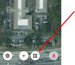
To get to the shape tool open up a project and go to the map. At the bottom of the screen, there is an icon in the shape of a polygon.
Upon opening the editor you will be presented with several options: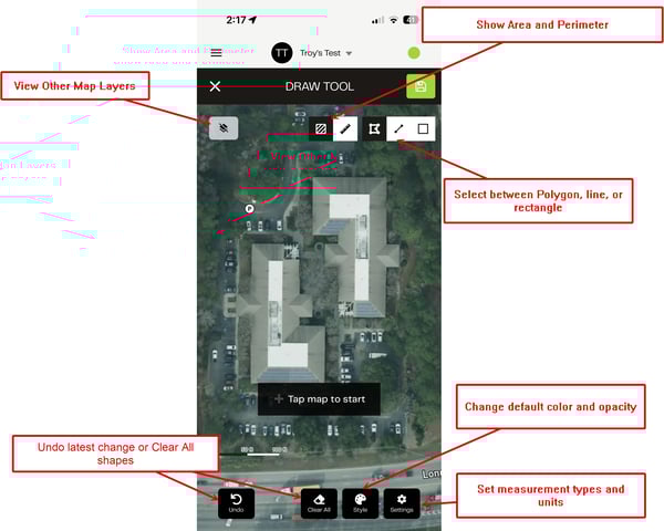
- Ability to toggle other layers
- Shape Type Selection
- Measurement Selection (area or perimeter)
- Undo and Clear All options
- Style Changes
- Settings to control units
Creating Shapes
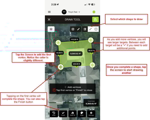
- Creating a shape
- Select which shape you would like to draw, and start by tapping the screen where the first vertex should be. Continue tapping the screen to draw the shape.
- Tap on a vertex twice to delete it
- Tap on the + to add a new vertex
- All vertices can be moved to change the shape
- Complete the shape by tapping the first vertex, or by tapping the Finish button at the bottom.
- Tap the screen again to start a new shape. All shapes will be saved under one layer
Styles and Settings
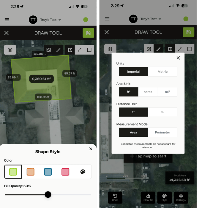
Style Changes: Adjust the color of the shape to match what color is seen for an exisiting shape, or set what new shapes will have. You can also set the shape opacity here
Settings: Set what units you want to see for Area, Distance, and if you prefer to see area or permiter primarily
Editing After Saving
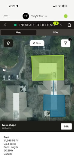
 Once the layer is saved to your project, you can enable it just like any other layer. But we added functionality to tapping on the shape and having information displayed:
Tapping on the Edit icon in the bottom right allows you to open up the editing screen again and make the changes you want.
To Edit a specific shape, tap on the desired shape, and you will see an Edit option appear.
After Editing, you can click the save button in the top right to save your changes to the existing layer.
Important Note: You will be able to edit web admin shapes from here as well, however it is limited to shapes that can be created on mobile (polygon, line, and rectangle). Shapes like the circle will have to be edited from web.
Web Shape Tool: